

In 2009, the Cobble Hill Association marked its 50th anniversary.
One of the ways in which the CHA celebrated the milestone was by compiling a history of the area, from the days of the Canarsie tribe, who lived here when the Europeans first arrived in the 17th century, to the first decade of the 21st century. The history was researched and written by neighbor Franklin Stone, who also found the illustrations and provided funding for the printing.
The History Committee can imagine no more fitting way to launch our section of the website than to reprint this engaging document.
Scroll down to read the full history or you can click here to download the PDF in its entirety.
A Brief History of Cobble Hill
by Franklin Stone
Beginnings
The archaeological and ethnographic record makes it clear that Native Americans occupied the area now known as Brooklyn for thousands of years prior to the arrival of Europeans. Many of the major thoroughfares in Brooklyn were once the approximate routes of Native American trails that were adopted by early colonists and turned into formal roads. In the 1600s, Brooklyn was occupied primarily by the Carnarsie tribe, a subtribe of the Delaware.
In 1636, about twelve years after the establishment of New Amsterdam on the southern tip of Manhattan, a handful of Dutch settlers spread across the East River to set up plantations on the westernmost edge of Long Island. They bought nearly 1,000 acres of land east of present-day Court Street from the Native Americans and named the area Gowanus. As the Dutch settled into the area, they quickly transformed the marshland into farmland and utilized the creek for transporting their goods. In 1646, the first Dutch community on the island was incorporated and called Breuckelen, Dutch for “broken ground.” The first settlers placed their farms along the Indian trail that ran from the East River southward.
The area now known as Cobble Hill was first settled by Dutch farmers in the 1640s when Dutch Governor Willem Kieft granted patents for farms north of Red Hook, from the East River to the Gowanus valley, legalizing the many farms already located in that area. Frederick Lubbertsen, Jan Manje, Claes Jansen van Naerden (aka Ruyter), and Andries Hudde were among those who received patents for large tracts of land in this area.
Lubbertsen’s large tract extended about a mile along the shore from the foot of the present Atlantic Avenue. Much of it was salt meadows, ponds, and tidal creeks with small wooded islands and sand banks, the last deposits of the glaciers. Lubbertsen built a large farmhouse, which included a large oven capable of baking at one time the equivalent in flour of about a bushel and a half of grain. This suggests the presence of a considerable force of work-hands, perhaps including slaves. In the 1600s the Van Rycken (aka Suydam) family acquired land and built a house at the corner of Hicks and West Baltic streets. Old Red Hook Lane was laid out in 1760, running roughly north-south near present-day Court Street.
In 1664, Brooklyn fell into English hands. In 1683, the English organized the five old Dutch towns of southwestern Long Island and the English settlement at Gravesend into Kings County.
In 1679, the Cobble Hill area was still an agricultural community, as described in the Labadists’ travel diary:
It is impossible to tell how many peach trees we passed, all laden with fruit to breaking down.… We came to a place surrounded with such trees from which so many had fallen off that the ground could not be discerned, and you could not put your foot down without trampling them; and, notwithstanding such large quantities had fallen off, the trees still were as full as they could bear. The hogs and other animals mostly feed on them.
The highest point in this region was a “peculiarly aggressive hill” that reared up solitary and alone among the cornfields of the surrounding farms, covering most of what is now the block bounded by Atlantic, Pacific, Clinton, and Court Streets. The Dutch called this highest point “Ponkiesbergh.”
In 1680 Frederick Lubbertsen died, leaving his Breukelen property to his two daughters by his second wife: Aeltje, who married Cornelius Sebring (aka Seuberingh), and Elsje, who married Jacob Hansen Bergen. He also left land to his three step-sons Cornelis, Pieter, and Hendrik Corsen. In 1698 Cornelius Sebring bought from Pieter Corson one hundred acres in the area of Brooklyn commonly called Lubbertsen’s Neck, next to the lands of George Hansen Bergen and Jacob Hansen Bergen. This neck has now lost its original appearance by the filling in of the Atlantic docks, the grading of streets, and the various improvements of the modern city. For many decades, the Sebrings operated a mill on their land near Red Hook.
The land covered by the three patents to Manje, Hudde, and van Naerden were subsequently purchased by Dirck Janse Woertman and eventually, with some of Lubbertsen’s land, became the large estates of Jonas Remsen and Philip Livingston. In the late 1600s some of the Sebring property passed to Whitehead Cornell, who married into the old Sebring family. By this marriage and probably also by purchase, the Cornells became major landholders and joined the ranks of the most respectable citizens of old Brooklyn—“all staunch King and Church men.”
On the eve of the Revolutionary War, the Cobble Hill area boasted several substantial farmhouses of old Dutch families. Maps survive from the pre-Revolutionary period, including Ratzer’s survey of Brooklyn in 1766-67, which described the very steep, conical hill on the west side of Red Hook Lane as “Cobleshill.”

On August 27, 1776, Cobble Hill played a major role in the Battle of Brooklyn. This battle was the first major engagement in the Revolutionary War after independence was declared, and the largest of the entire conflict. British troops forced the Continental Army under George Washington off the heights near the modern sites of Green-Wood Cemetery, Prospect Park, and Grand Army Plaza. During the battle, Washington viewed the particularly fierce fighting at the Gowanus Creek from atop the steep, conical “Cobble Hill Fort.”
The fortified American positions became untenable and were evacuated a few days later, leaving the British in control of New York Harbor. While Washington’s defeat on the battlefield cast early doubts on his ability as commander of the armies, the subsequent tactical withdrawal of all his troops and supplies across the East River in a single night is seen by historians as one of his most important successes.
The British controlled the region for the duration of the war and leveled Cobble Hill Fort so it would not overlook their headquarters in Brooklyn Heights. The British also appropriated the estate of Philip Livingston and occupied it as a naval hospital. British sheds and huts for the sick were erected on the banks of the river south of present-day Atlantic Avenue and east of Hicks Street. Along the river between present-day Pacific and Warren Streets several hundred British sailors and soldiers were buried in regular rows. The westernmost row was exposed to the lashing of the waves of the East River and, for many years afterwards, the remains of these poor fellows were from time to time disinterred by the actions of sea and shore.
Most of the Sebrings, who were anti-British Whigs, left Long Island after the departure of the American troops in August 1776. The Sebring home and mill near Red Hook were burned by the British and the family found themselves impoverished on their return after the war and obliged to dispose of their property. The Cornells were loyalists who became friendly with the British officers. At their urging, an English Colonel Thornel built a large house at what is now Strong Place on land sold to him by the Cornells.
The Nineteenth Century
Many changes came to Cobble Hill in the Federal period. The early days of the 1800s marked the point at which the steady stream of immigrants to Brooklyn from Europe—particularly Ireland and Germany—became a flood. The swelling workforce encouraged industrialization and vice versa, and by the middle of the 19th century, the Brooklyn waterfront (and the government’s newly christened Brooklyn Navy Yard) was dominated by factories, textile mills, and other manufacturing centers, and the little village of Breuckelen had become a city in its own right.
In 1810 Brooklyn had a population of 4,402. There were 400 houses, fifty to sixty ships docked annually at its wharves, six grain or tide mills, three magazines for storage of gunpowder, several distilleries, three ropewalks, one Episcopalian stone church, one Reformed Dutch stone church, one Methodist church, one poor house, and two market houses situated in the open spaces near the old and new ferries. By 1850, the population of Brooklyn had risen to 96,838.
The old Red Hook Lane, laid out in 1760, was straightened into Court Street. By 1823, Henry Street was opened to connect directly with Brooklyn Heights. Property which had which had been covered by the Dutch patents, and subsequently by the Remsen and Livingston estates, was sold to relative newcomers.
The first stage in the development of Cobble Hill occurred in the blocks along the west side of Henry Street where the dramatic view of the harbor led owners to establish their rural homesteads or rural suburban mansions. At the north end, Ralph Patchen built a home just south of Atlantic Avenue in the bed of present-day Hicks Street near his distillery and dock. Patchen eventually covered some 150 acres and the private Patchen’s Road led from his farm on the East River to Red Hook Lane. This country lane was swallowed up by District Street, which became the southernmost boundary of the Village of Brooklyn, incorporated in 1816. In 1855, District was renamed Atlantic Street, and by the 1870s it was designated an Avenue.
The next block south on Henry Street, originally part of the Patchen farm, was acquired in the 1830s by Joseph A. Perry who built a handsome, block-long Greek Revival mansion. Further south, the land between what is now Amity, Congress, and Court Streets and the East River, was acquired by Cornelius Heeney, a successful fur merchant, who built a summer home at Henry and Amity. Further south on Henry near Warren, Noel Becar built a large Greek Revival mansion and greenhouse.
Still further south, Parmenus Johnson purchased the old Suydam farm and built a house which occupied the entire block between Henry, Hicks, Warren, and Baltic Streets and was surrounded by pear trees a century old. Johnson owned the sixteen acres bounded by Congress, Baltic, and Court Streets and the river, and tripled the size of his property by filling in and docking out on his waterfront. In 1833 his farm was cut up and sold off in small plots, making him one of Brooklyn’s wealthiest citizens of the time.
The southernmost farm in present-day Cobble Hill belonged to the Cornells, whose farm extended from Baltic Street to nearly Congress and from Red Hook Lane to the East River. The Cornell home and flour mill were located near the harbor, just outside what is now the Historic District. A considerable portion of the Cornell farm near Baltic Street was purchased by Selah Strong, a merchant and comptroller of New York City, who occupied the house built by Colonel Thornel in the bed of present-day Strong Place.
None of these rural houses survive, nor are there any houses in the colonial or federal style remaining in Cobble Hill. The next stage in the development of Cobble Hill was the breaking up of these large land holdings. Patchen’s large farm occupied more than a dozen blocks between what is now State and Amity Streets and was closest to the Fulton ferries. It was broken up into lots by 1832 when the oldest still-standing house in the Historic District, 122 Pacific Street, was built in the Greek Revival style.

The development of Cobble Hill into an urban residential district escalated in the mid-1830s, with a boom in speculative real estate development associated with the establishment in 1836 of the ferry service at the foot of Atlantic Avenue. The gridiron pattern of streets was established by 1834 and extended south from Atlantic to Butler Street. Below Butler Street the old lanes and the new street design crisscrossed haphazardly for some time, except for Strong Place, which was regulated and paved as early as 1836.
Following the Fire of 1835, when his house in Manhattan burned down, Cornelius Heeney moved permanently to Brooklyn, where he spent the remainder of his days. Heeney, who never married, was known for his generosity. In 1784 he had left his native Ireland and sailed for Philadelphia. Entering the Delaware River, his ship was struck by lightning and wrecked. Oystermen laboring in the vicinity rescued the passengers, charging a dollar for each passenger put ashore. A friendly Quaker lent Heeney the money, saying, “Whenever thou seest a fellow creature in want of a dollar as thou art now, give it to him, and thou shalt have repaid me.’’
Many orphan children were educated by him, and not a few of his female protégés married into highly respectable families. His fine Brooklyn orchard was utilized every summer for fresh air parties for orphan children, who were given all the apples, cherries, and other fruit they could consume. Wood was also distributed to the poor of the neighborhood, and he contributed generously to many charitable associations and churches of New York and Brooklyn. When he died in 1848, Heeney left his estate to the Brooklyn Benevolent Society for the support of the Catholic Orphan Asylum Society. He is buried in St. Paul’s Church, at the corner of Court and Congress Streets. Unlike neighboring estates, the Heeney property was not sold, as the Society adopted the policy of giving only lease-hold titles and reserving a ground rent to yield the largest income on the property.

In contrast to Manhattan, the rows of houses first built in Cobble Hill were either built individually or in rows, ranging anywhere from three houses to groups which occupied half a city block. A handsome row of six Greek Revival houses at 228-238 Warren Street, erected between 1833 and 1835, are the earliest significant row of houses in the neighborhood—and still one of the most beautiful. According to the 1840-41 tax lists, there were already rows of houses on Pacific, Warren, and Baltic Streets in the blocks between Clinton and Henry Streets, as well as on Strong Place. In 1845, according to the recollections of the Rev. Sewall S. Cutting of the Strong Place Baptist Church:
On this side of Atlantic Street I recall no instance, in the streets running either way, unless, near the river, where any street was built from one corner to another. In all the district from Atlantic Street to Carroll, the buildings were dwellings in detached clusters. Whole blocks were without a building on them, or with no more than two or three or four. Everywhere were footpaths across the blocks to make shorter routes to the South Ferry. My own family had been in 1845 the first to occupy a house in the row of houses on Harrison (Kane) Street, fronting Strong Place.
Many of the original builders of Cobble Hill are unknown, but some names occur with great regularity as early as the 1840s, among them Asa Stebbins, William Johnson, Horatio White, Thomas Sullivan, Michael Markey, Jeremiah O’Donnell, and Jacob Carpenter. According to the 1969 Cobble Hill Historic District Designation Report, some of these rows contain “examples which are virtually unique in the City and which give Cobble Hill its special distinction.”

The architectural styles represented in Cobble Hill include the Greek Revival of the 1830s and 1840s, followed by the Gothic Revival, Italianate, and the early Romanesque Revival styles of the 1850s and 1860s. The French Neo-Grec style which appeared in the 1870s was followed by the Romanesque Revival, the Queen Anne style, and the new classicism influenced by the Chicago Fair of 1893. The District also has many “transitional” houses which display the characteristics of one or more periods when one style was giving way to another. Materials are in the masonry tradition with brick and brownstone predominating. Ironwork includes both the standard die and castings to be found in other parts of the City as well as several most unusual designs not to be seen elsewhere. In its quality, quantity, and variety Cobble Hill’s housing stock is some of the best in the City.
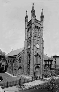
Cobble Hill also drew the attention of two famous 19th-century architects. Richard Upjohn in 1842 designed the Gothic Revival Christ Episcopal Church at Clinton and Kane Streets. In 1852 Minard Lafever designed the Gothic Revival Strong Place Baptist Church at DeGraw Street and Strong Place. Upjohn, and later his son Richard M. Upjohn, made their home at 296 Clinton Street.
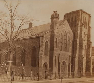
Other churches were also built during this period. In 1855 the Romanesque Middle Reformed Dutch Church was built on Kane Street. The buildings were later owned by the Salvation Army and the Trinity German Lutheran Church, and in 1905 became home to the Harrison (now Kane) Street Synagogue. In 1857, the well-known architect Jacob Wrey Mould designed the Second Unitarian Church at Clinton and Congress. The building was in the shape of the cruciform, with a low pitched, concave roof covered with green and purple octagon slates in alternate rows, resembling a tortoise for which it became known as the “Church of the Holy Turtle.” This church became a cultural and abolitionist center and one of its parishioners, Mary White Ovington, was a founder of the National Association for the Advancement of Colored People (NAACP). The Roman Catholic centers of St. Paul’s at Court and Congress Streets and the Romanesque Revival St. Peter’s Church at Hicks and Warren, built in 1859-60, included schools, an orphanage, and a hospital.

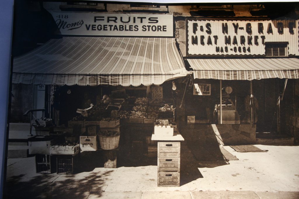
By 1860, Cobble Hill had been converted from a sparsely populated rural outpost into a quiet and comfortable suburban community, complete with banks, stores, and other services, as well as many churches whose steeples rose against the skyline. Its residents were moderately well-to-do, middle-class citizens. Throughout the late 1800s, the Brooklyn Daily Eagle contains many advertisements seeking cook, laundresses, maids, and other servants for homes in the area. In the late 1800s, fashionable shopping along with waterfront commerce and manufacturing firms defined the Avenue.
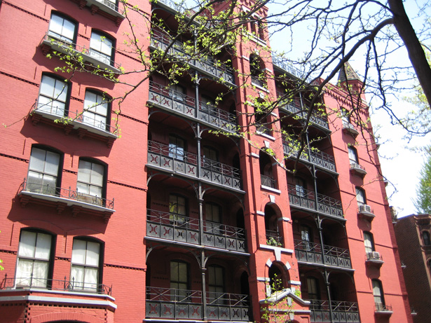
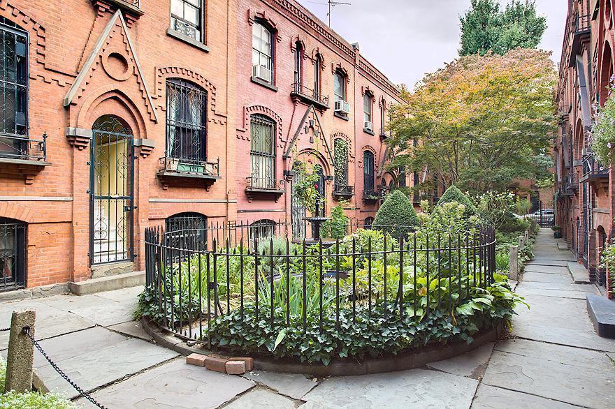
In the 1870s, Cobble Hill also became home to two of the earliest experimental housing projects in the country—the Home & Tower Buildings and the Warren Place Workingmen’s Cottages—both designed by William Field & Son. A sociological experiment sponsored by Alfred Treadway White, a Brooklyn merchant and philanthropist, these buildings were landmarks in the field of tenement house reform. The Tower Buildings at Baltic and Hicks Streets provided ample light and air to all rooms and carried such luxuries as private toilets, decorative iron railings, and a garbage chute. Behind the Tower buildings, White laid out Warren Place, a group of 34 tiny houses grouped around an inner garden courtyard. Although the dwellings served working-class tenants admirably, Alfred White insisted that he built them not as a philanthropist but as a sound business investment and as proof of what could be done to improve conditions throughout the city. Today Warren Place is described as “Brooklyn’s most charming residential enclave.”
The rapidly expanding city of Brooklyn annexed the neighboring areas of Bushwick, Gravesend, Flatbush, New Utrecht, Williamsburg, and New Lots, becoming the third largest city in the nation by 1860. Cobble Hill was generally known as South Brooklyn (or the Sixth Ward) because, until 1894, it was the southernmost part of the City of Brooklyn. Later, all of Kings County was incorporated into New York City in 1898. In the late 1800s, however, Brooklyn Daily Eagle articles also refer to the area just south of Atlantic Avenue as “Cobble Hill,” after the Revolutionary War fort.
The Twentieth Century
Other than a few houses from the 1890s and some apartment houses built early in the twentieth century, little physical change occurred in Cobble Hill since White completed his work. Fortunately, because the neighborhood escaped the “improvements” that marked the 1920s and 1930s, much of its original character remained intact. In the 1930s, on blocks of Atlantic Avenue blocks near the waterfront, Middle Eastern immigrants began opening restaurants and food shops.
From the 1950s through the 1970s, Brooklyn’s fortunes and population declined as manufacturing plants deserted the area and residents moved to nearby suburbs. By the mid-1950s, residents of Cobble Hill and the surrounding brownstone neighborhoods began to sell their brownstones at low prices. It seemed that cheap rooming houses would engulf the area in a few years.
Fortunately there were young families who bucked the trend to the suburbs. These families found spacious brownstones at attractive prices and bought them with an eye toward maintaining and restoring their elegant design. Older residents, chiefly Irish, Italian, Greek, Syrian, and Lebanese who had clung to their family homes, welcomed the new arrivals.
On May 24, 1958, the Cobble Hill Association was formed in response to developmental threats to the historic neighborhood, including a plan to demolish the area bounded by Atlantic Avenue and Pacific, Henry, and Hicks Streets for a low-income housing project. The stated goal of the Association was to preserve and improve the residential quality of the Cobble Hill neighborhood. The November 1, 1958 membership invitation states:
You may have read in the newspapers that our area is again being considered for slum clearance. It will take vigorous effort on the part of each of us to oppose these plans successfully… Your help and support is very much needed to fight the blight and deterioration which can reduce the value of our homes and make our neighborhood an unsafe and undesirable place to live. By joining together we can accomplish as a group what we cannot do as individuals.
Under the CHA’s leadership, more than 1,700 signatures were gathered for a petition opposing the housing project. Continued protests led to the abandonment of the project by the Housing Authority and the preservation of many historic buildings.
In 1959, the CHA also led area residents in a battle against development on the area bounded by Verandah Place and Clinton, Congress, and Henry Streets. Three buildings had formerly stood on the site: the Weber and Whitten mansions and the abandoned Second Unitarian Church. During the late 1940s the mansions had been demolished and, in 1959, the owner proposed the construction of a supermarket on this site. Opposition by the CHA and community protests led to the abandonment of this plan.
In 1960, the New York Times lauded the CHA: “An example of what a tough minded group of homeowners can do to restore the quality of their neighborhood has been demonstrated in a twenty four block area just south of Brooklyn Heights.” The Times noted that all the area’s residents were joining the “association’s effort to preserve the area’s last-century charm.”
In 1962, the Verandah Place and Clinton property was sold to private builders who razed thechurch and moved forward with plans to construct a six-story 128-family brick apartment building on the site. News of a budding neighborhood park movement prompted the builders to move up their construction schedule to July or August of 1962.
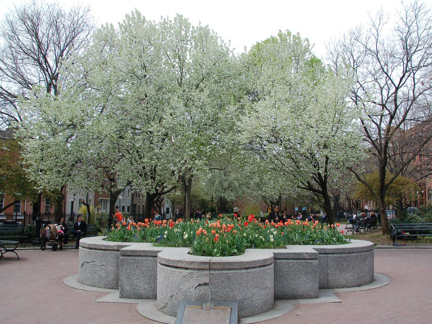
From late April to July 1962, the CHA and residents of Cobble Hill mobilized to convert the property into a public park. They collected 1200 signatures and successfully petitioned the City Planning Commission, Bureau of Budget, Parks Department, and the Mayor’s Office. The plot officially became City property on March 7, 1963. Plans were soon underway to construct a park that would both provide an area for passive recreation and protect a heavily urbanized area from further development. Cobble Hill Park was formally dedicated on July 14, 1965. Its prominent features at the time included new trees and shrubs, game tables, concrete walls, and a sand pit area. Described in the New York Times as a test of the “theory of small park feasibility,” it became the City’s first “vest pocket” park.
In the 1960s, Cobble Hill began to thrive again as young professionals realized that there were tremendous housing bargains to be found in the neighborhood, just a few subway stops from Wall Street. According to the New York Times, “More and more brownstones are being sold at between $10,000 and $20,000 for owner occupancy.” As the Landmarks Preservation Commission (LPC) described it:
Cobble Hill is currently undergoing a renaissance as young couples acquire and renovate the attractive, moderate sized houses on its tree-lined streets. Like Brooklyn Heights, it is emerging from a rather long period of quiescence. This period actually protected it from the rapid pace of rebuilding and alteration, so typical of much of the City. Most of the fine, old houses were preserved with little change. Apartment houses appeared in the area in the 1880s but they are not very high and few were built there after the 1920s. The fact that apartment houses did not invade the streets in recent years is responsible for the charming, low lying quality of this neighborhood where the skyline is punctuated occasionally only by church spires.
In 1969, after months of research and fact checking by the CHA, Cobble Hill was designated as a historic district and, with “many tree-lined streets and rows of architecturally notable houses,” came under the protection of the City’s landmark preservation laws. Together with low-scale zoning, including a 50-foot height limitation, these laws have been responsible for preserving the nineteenth-century scale, feeling, and quality of the buildings and streets of Cobble Hill.
In 1970s, the CHA led the effort to defeat a proposal to widen Atlantic Avenue into a highway, which threatened the destruction of the adjacent houses. Hundreds of Cobble Hillers chartered buses to Albany and picketed the legislature, forcing the abandonment of the plan. Two years later, the CHA worked to redraw the boundaries of the proposed container port so that fewer families would be displaced by this much-needed facility. It also began a major tree-planting program, now institutionalized by CHA’s establishment of the Cobble Hill Tree Fund, to permit tax-deductible donations for street trees. In 1976, the Association succeeded in getting Cobble Hill listed on the National Register of Historic Places.
In 1981, 18-year-old Bob Diamond entered a manhole at Atlantic and Court Street and discovered a long-lost Long Island Rail Road tunnel that once ran from Hicks Street to Boerum Place. Constructed in 1845, the Cobble Hill Tunnel was part of the first rail link between New York City and Boston, via Long Island and Connecticut. In 1861, the state legislature voted to ban railroad locomotives within the limits of the City of Brooklyn, and the ends of the tunnel were sealed. Diamond opened access to the main portion of the tunnel, popularized the tunnel as an antiquity, and began leading tours of its interior. It has been listed on the National Register of Historic Places since 1989.
In 1984, the Cobble Hill Community Fund was established to support local non-profit agencies and organizations. Also in the 1980s, the CHA joined neighboring community organizations to fight waterfront development plans for Piers 1 through 6. It became a founding member of the Brooklyn Bridge Park Coalition and helped develop the 13 Guiding Principles that were intended to govern the design for a park on the site.
In 1989, at the instigation of the CHA, Cobble Hill Park was reconstructed. The new design won the 1988 Annual Award for Excellence in Design from the Art Commission and the Parks Council’s first Philip Winslow Award for Public Projects in 1990. The steel-panel fencing and concrete slabs of the 1960s park were replaced by a design more in harmony with the surrounding Greek Revival architecture. The formal, geometric pattern of present-day Cobble Hill Park utilizes 19th-century period materials such as blue stone and cast iron as well as granite entrance columns and herringbone-patterned brick walkways.
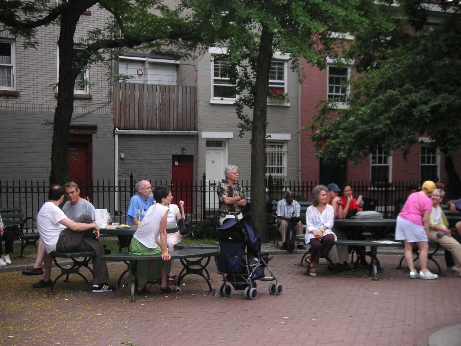
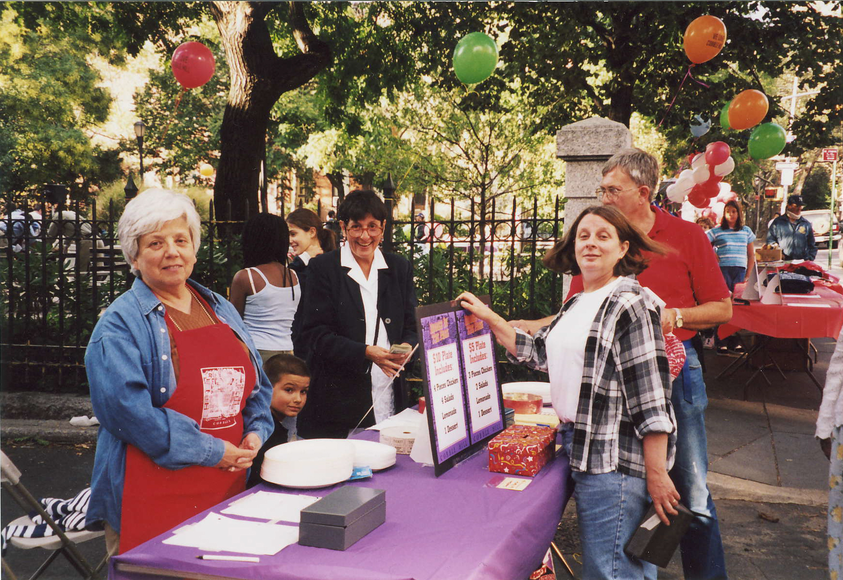
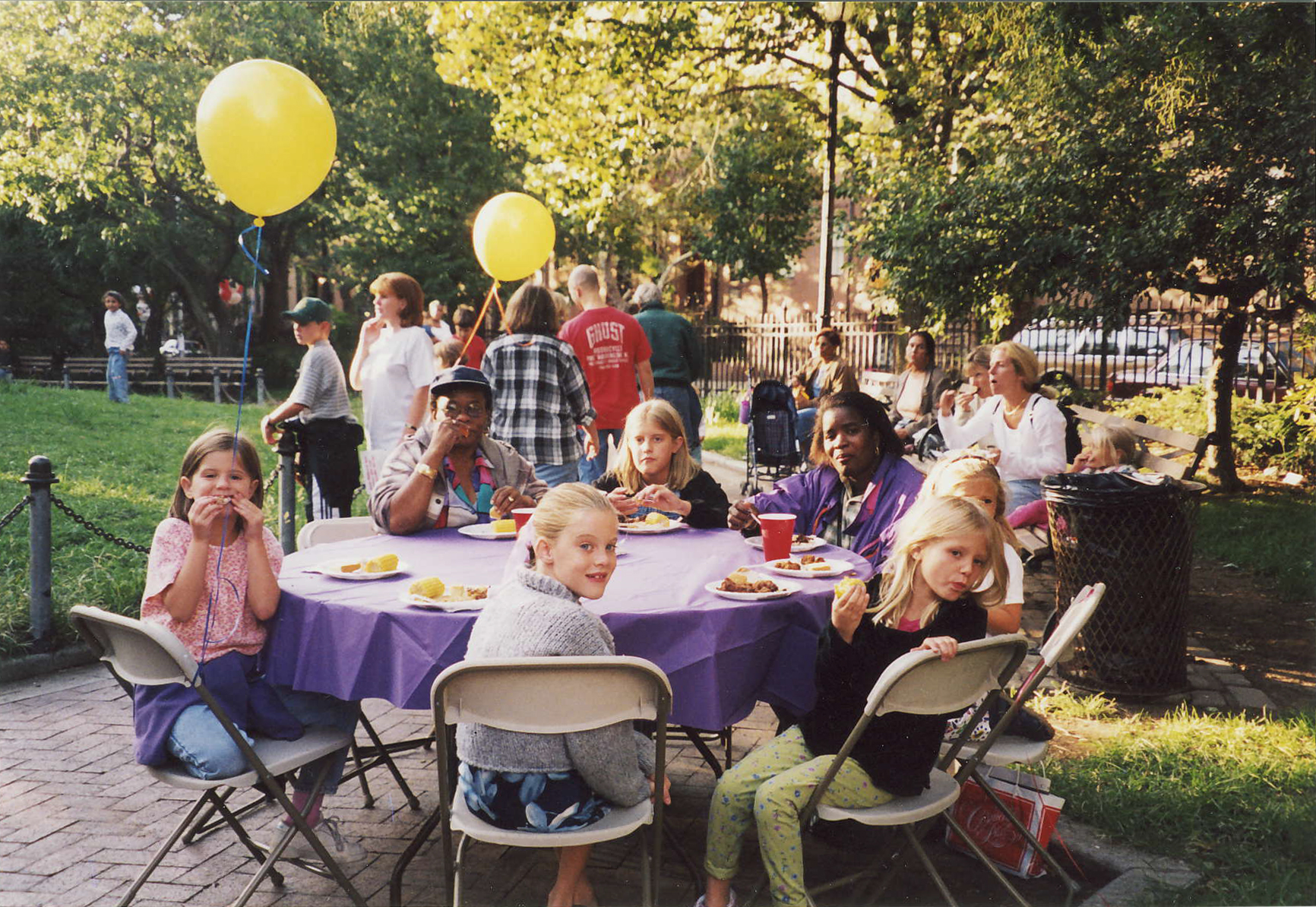
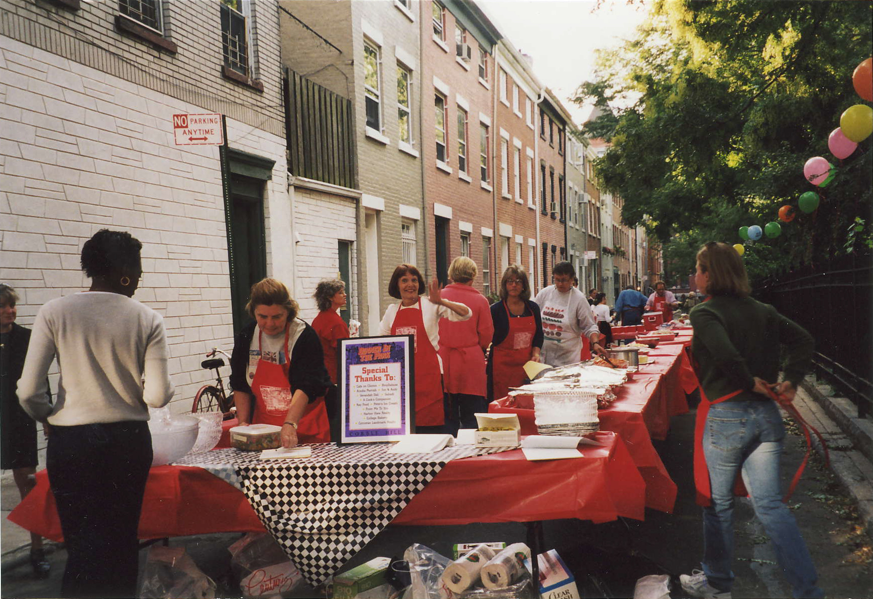
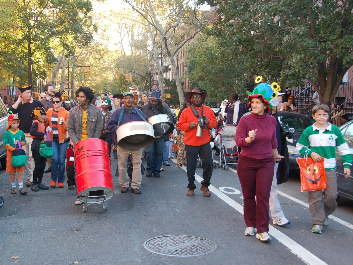
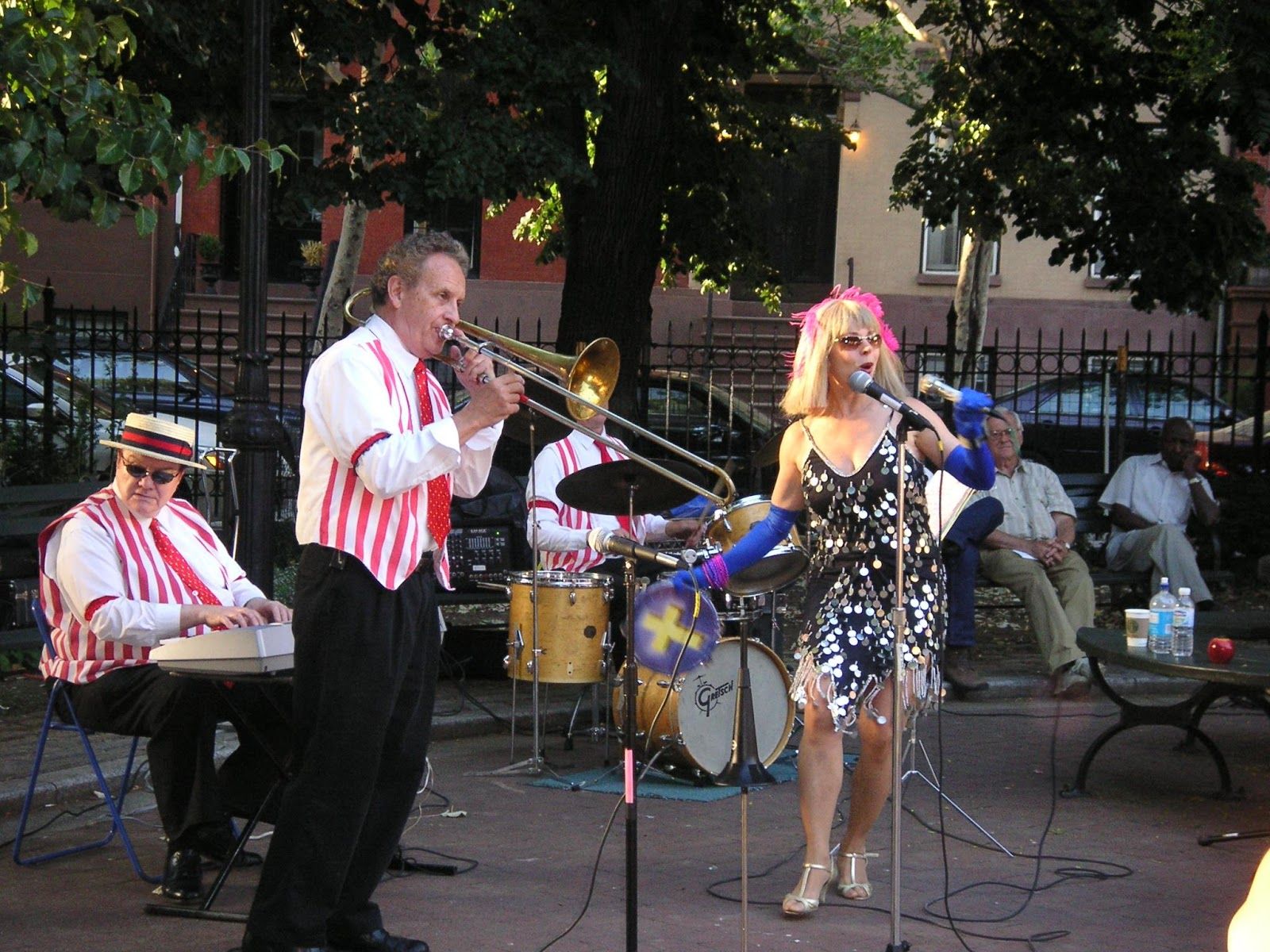
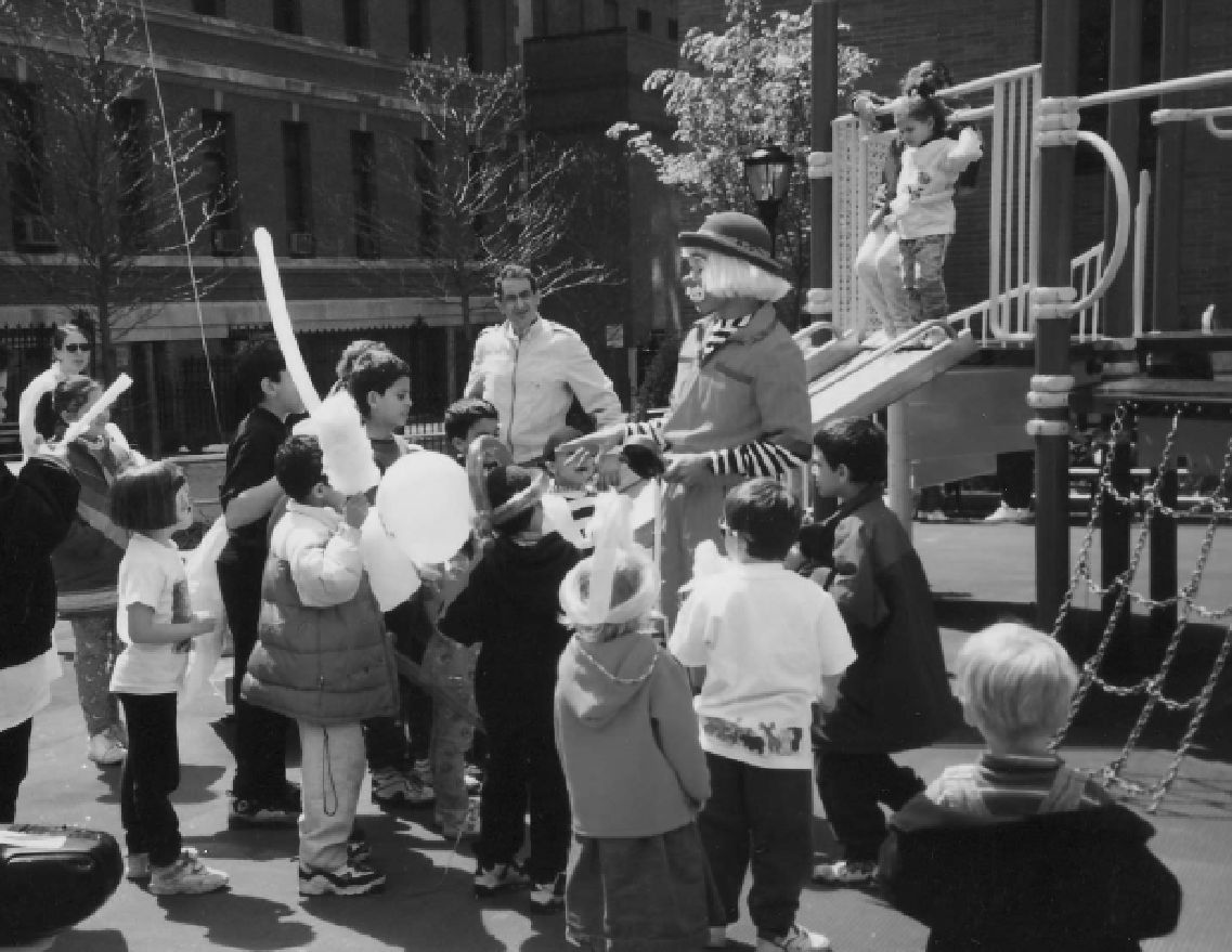
Shortly after the restoration, the CHA began sponsoring an afternoon Halloween Parade in Cobble Hill Park. The annual event, which began as a gathering of just a few families, has now swelled to accommodate over a thousand ghouls, ghosts, and goblins on the streets of Cobble Hill. The CHA also initiated a series of Dinners in the Park and the very successful summer concert series in Cobble Hill Park, which continues to be enjoyed by hundreds of residents, young and old.
In the late 1980s, the integrity of the residential neighborhood was threatened by Long Island College Hospital’s proposal to build a large parking garage on Henry Street at Pacific Street. Although the construction of the garage on this site was “as of right” under the law, the CHA persuaded LICH to instead place the garage on the other side of the hospital on the site of a little-used playground adjacent to the highway. LICH also agreed to create three new parks on the community side of the hospital, to expand the historic district, and to sell hospital-owned brownstones. Years of public hearings and litigation pitched LICH and the CHA against well-intentioned and well-financed opponents. In the end, LICH constructed its garage by the highway, away from the residential community. These dedicated playgrounds are now among the most used in the area, teeming with children, residents, and lunching hospital staff.
In 1999, the CHA played a vital role in another significant challenge—Mayor Rudolph Giuliani’s threat to close down the community service organizations at 250 Baltic and replace them with a homeless shelter for mentally ill men. The mayor’s action came in the wake of a feud over the administration’s homeless policies with the area’s City Council Member. The action would have uprooted Families First, South Beach Psychiatric Center, Community Board 6, and a senior citizen drop-in center run by the Heights and Hill Community Council. After many months of community activism, protests, petitions, and litigation, the eviction order issued to tenants at 250 Baltic Street was rescinded and the City agreed to drop its proposal for a new homeless shelter at that location.
In addition to these major efforts, the CHA also provided leadership in other areas. It successfully lobbied for the return of regular alternate-side parking regulations after decades of having our streets designated as through-traffic streets with rush hour regulations. It worked with city agencies on the planning and execution of the Clinton Street water main replacement project. It also lobbied for and obtained historic lampposts on Clinton Street.
The CHA also worked closely with other neighborhood groups towards goals of mutual interest. It was a driving force for the development of Brooklyn Bridge Park, participating in the design process that succeeded in attracting over $164 million of state and local funding for a new park that will stretch from Atlantic Avenue to the Manhattan Bridge.
The Twenty-first Century
Today historic Cobble Hill is a modern urban American neighborhood characterized by a vibrant mix of ethnic, economic, and cultural diversity. The CHA has continued to effectively represent the interests of the community with all levels of government, public and private institutions, the business community, and the press.
In 2001, the Cobble Hill Community Fund opened the new, street-level Cobble Hill Community Meeting Room at 250 Baltic Street. The space, which has a separate private entry, is available to any non-profit group or organization in the Community Board 6 area.
In 2002, it gathered leaders of civic associations representing the communities along Atlantic Avenue and helped secure $350,000 in funding for a master planning process that focused on greening, pedestrian safety, and improving Atlantic Avenue. The CHA was also instrumental in obtaining over $2 million worth of renovations to Van Voorhees Park, including a new playground, two new tennis courts, a fully fenced basketball court, renovated handball courts, and a new ball field.
The CHA has continued to be a driving force for the development of Brooklyn Bridge Park. It lobbied successfully for a $1 million Brooklyn Bridge Park Transportation Access Study Grant secured in 2002 by Congresswoman Nydia Velázquez. It stands opposed to the Brooklyn Bridge Park Development Corporation’s plan to erect 400 apartments in two buildings, one 30 stories tall, at the foot of Atlantic Avenue on the upland of Pier 6 and has lobbied for additional recreation facilities and a major park entrance at Atlantic Avenue. The CHA also renewed a proposal to “Fix the Ditch” and bridge the BQE trench to rejoin Cobble Hill with the Columbia Street neighborhood.
In 2008, the CHA faced the most direct attack on the 50-foot height limitation when developer Two Trees sought to convert the magnificent Independence Savings Bank building to residential use and to construct a new 60-foot high apartment building adjacent to it. With the support of the Brooklyn Heights Association, the CHA fought the proposed project. Today, the bank building, now Trader Joe’s, retains its original height.
Most recently, the CHA’s Green Committee organized the first Annual Cobble Hill Bike Ride, a 12-mile loop that paused at ecological points of interest, and has worked with the Court Street Merchants Association to encourage recycling of plastic bags, canvas bag use, and the use of compostable cutlery and cup-ware.
Today, as we celebrate fifty years of neighborhood service and launch the Cobble Hill History Project, we are proud of our role in the campaigns to maintain Long Island College Hospital as a full-service hospital and to remove the proposed new housing from the future Brooklyn Bridge Park. Thank you for joining us as we begin our second fifty years.
The People of Cobble Hill
Learn more: Bibliography and Image References
Explore: Historical Maps of Brooklyn and Cobble Hill
Cobble Hill Association History:
Past Cobble Hill Association Presidents
Cobble Hill Association Timeline: History of Achievements
Sources for A Brief History of Cobble Hill:
Bergen, Teunis G. Register in Alphabetical Order, of the Early Settlers of Kings County, Long Island, NY, 1881.
The Brooklyn Daily Eagle, Brooklyn Collection, Brooklyn Public Library
Brooklyn Historical Society
Cobble Hill Historic District Designation Report, New York City Landmarks Preservation Commission, 1969
Furman, Gabriel. Notes Geographical and Historical, relating to the Town of Brooklyn, in Kings County on Long-Island, 1824
John Carter Brown Library, Brown University
Lionel Pincus and Princess Firyal Map Division, The New York Public Library Digital Collections.
Lossing, Benson J. Pictorial Field Book of the Revolution, Vol. II., 1850
McKinley, Albert E. The English and Dutch Towns of New Netherland. American Historical Review 6 (October 1900): 1-18.
Morrone, Francis and Iska, James. An Architectural Guidebook to Brooklyn. New York, Gibbs Smith, July 2001.
The New York Times
Ostrander, Stephen M. A History of the City of Brooklyn and Kings County in two volumes. Brooklyn, NY, published by subscription, 1894
Stiles, Henry Reed. A History of the City of Brooklyn: including the old town and village of Brooklyn, the town of Bushwick, and the village and city of Williamsburgh in two volumes. Brooklyn, NY, published by subscription, 1867
Stuart, Diana. Decorative Architectural IronworkAtglen, PA, Schiffer Publishing Ltd., 2005
Suydam, J. Howard. Hendrick Rycken: The Progenitor of the Suydam Family in America: A Monograph.
Thompson, Benjamin Franklin, The History of Long Island from Its Discovery and Settlement to the Present Time. New York, NY, Gould, Banks & Co.,1843
Van Wyck, Frederick. Long Island Colonial Patents, Jan 1935
Wilson, James Grant. Memorial History of the City of New-York from its First Settlement to the year 1892. New York, New-York History Society 1893.
Maps:
Ratzer, Bernard. Plan of the City of New York in North America: surveyed in the years 1766 & 1767. Lionel Pincus and Princess Firyal Map Division, The New York Public Library. “Plan of the town of Brooklyn and part of Long Island.” The New York Public Library Digital Collections. 1767. http://digitalcollections.nypl.org/items/871fda48-ba46-c1d9-e040-e00a18064c0a
Plan of New York Island and Part of Long Island Showing the Position of the American and British Armies, August 27, 1776
Hayward, George. Lionel Pincus and Princess Firyal Map Division, The New York Public Library. “Hayward’s map of the city of Brooklyn : (copied from the Commissioner’s map).” The New York Public Library Digital Collections. 1843. http://digitalcollections.nypl.org/items/510d47da-f019-a3d9-e040-e00a18064a99
Hooker, William. Hooker’s New Pocket Plan of the Village of Brooklyn, 1827
Jas Bleeker & Sons, Executors Sale of Property Belonging to the Estate of Jordan Coles Decd 1836
Perris, William. Plan of the City of Brooklyn, Wm. Perris & J.H. Higginson, 1855